Saturday, July 23, 2016


Cathedrals of Stone

THE TRIP – Day 5
Richfield, Utah – Hurricane, Utah 
Kolob Canyons
157 miles


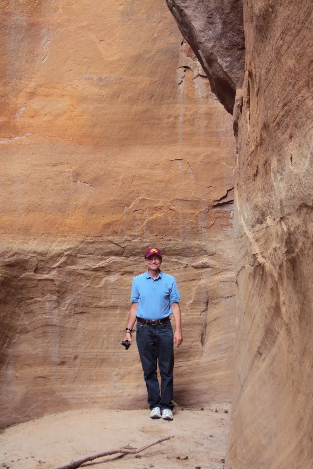
We had a short day of driving ahead of us before we arrived at a hotel near Zion National Park where we planned to spend the following day. A little research the previous night found a second, less developed section of Zion called Kolob Canyons that had an entrance and a scenic drive easily accessible from Interstate 15. This unplanned stop looked like a nice way to spend the afternoon. The twisty five mile road had many scenic pull-offs, with a parking area at its end and a trailhead for an even more scenic hike. We drove through towering rocks of rose-colored sandstone along a paved road of similar reddish hue. The roadside geological rock formations we had seen previously along the Utah highways paled in comparison to these rocks. These rocks were awesome, not in a “Hey, that's neat!” way but in a holy, magnificent, overpowering “...This...is...awe...some...” way. In a perfect world, I would have brought a lawn chair, found some shade, and just sat for hours, alternating between worshiping God and just sitting in silent awe in His presence within the walls of this incredible cathedral.  But I ended up doing a much abbreviated version of that, moving on from overlook to overlook, praising God and soaking in the ever-changing rock formations, marveling that the Creator of the universe was so inordinately fond of rocks and, of course, taking photos. We parked at the end of Kolob Canyons Road and headed out on the trail which led to an overlook facing south toward the distant north rim of the Grand Canyon. The path was lined with wildflowers, many of which I had never seen before, flowering cacti, and some cute, photogenic lizards. And the views continued to be ...awe...some... 


After our hike and return drive, we checked into our hotel and went to a local diner-type restaurant for dinner. Here we had the first of what would be three “Oneonta” encounters on our trip. My husband was wearing a tee-shirt from our alma mater, a small state school in Oneonta, New York. When we lived in New York, we regularly ran into people from New York who had never heard of it. Here, in a small restaurant in tiny Hurricane, Utah, a women from Utica, New York came up to us and commented on us being from New York, having recognized the Oneonta tee-shirt. Small school, small world...


As he was drawing near—already on the way down the Mount of Olives—the whole multitude of his disciples began to rejoice and praise God with a loud voice for all the mighty works that they had seen, saying, “Blessed is the King who comes in the name of the Lord! Peace in heaven and glory in the highest!” And some of the Pharisees in the crowd said to him, “Teacher, rebuke your disciples.” He answered, “I tell you, if these were silent, the very stones would cry out.” - Luke 19:37-40


 Next:
 
Tax Dollars Well Spent

THE TRIP – Day 6
Zion National Park
50 miles

Thursday, July 21, 2016


The Old Married Couple Meet the Kissing Couple

THE TRIP – Day 4
Grand Junction, Colorado – Richfield, Utah
Colorado National Monument National Park
223 miles


We had spent the night in Grand Junction and decided we would use the flex time the long first two days of driving had bought us to visit our first park, an unplanned stop at Colorado National Monument National Park. It was also our 39th wedding anniversary that day, so we planned to celebrate by arriving at the park early, doing some easy hiking, eating a backpack lunch and having a short afternoon of driving. Because we are POACA* the first thing I did as we entered the park was get a National Parks Senior Pass, a ten dollar purchase that is good for life. Yep, the rest of the parks on this trip would be free as were any we might plan to visit in the future.

Colorado National Monument, named for the monument-like rock formations in its canyon, had a long scenic drive as well as a number of both long and short hiking trails. We opted out of most of the long drive to hike a number of the shorter trails. We were above the canyon, on the rim, with excellent views of the monument rock structures. They had all been given names, some being Independence Monument, The Pipe Organ, The Kissing Couple. The Kissing Couple did in fact look like a man and woman kissing, he with a hat, she in a long dress and a bustle. We also walked around the Saddlehorn, another rock formation, quite different geologically from the monuments. Our last hike took us to the end of a slot canyon, where we walked and walked as the canyon walls got closer and closer together. The day was warm, but not hot, the park not crowded, the hiking pleasant and relatively easy. An excellent start to our national parks adventure.

Kissing Couple
Old Married Couple (39th Wedding Anniversary Selfie)

Monuments
The Saddlehorn
The Saddlehorn (detail)
In the slot canyon
Looking up from within the slot canyon
In the early afternoon we left the park, and headed into Utah, still on I 70. The Colorado Rocky-feel in the landscape began to change to a more desert-like feel. The views along the road were non-stop spectacular, but never the same. It was as though God didn't want to bore anyone traveling through the area, so He would change the color, height, or structure of the hills every few miles. Again we found rest stops that were just excuses to pull off the road and look and take pictures and look some more. We stopped for the night in Richfield, Utah, found a Super 8 and a fun restaurant restaurant right next door, R & R's Frontier Village, and had a nice anniversary dinner.


Just along the Utah roadside...Don't like it?
...Well, how about some rocks?
...Or maybe something like this?
...Or something like this?
There's a bunch of these around, too...
Darker?  Did you want darker?
Bigger, maybe?


This old thing?  Oh, just another rest stop...


* People Of A Certain Age

 
Look at life through the windshield, not the rear-view mirror. -Byrd Baggett


Next:

Cathedrals of Stone

THE TRIP – Day 5
Richfield, Utah – Hurricane, Utah
Kolob Canyons
157 miles

Tuesday, July 19, 2016


Seeing and “Resting”

THE TRIP – Day 3
Denver, Colorado – Grand Junction, Colorado
251 miles


I'm a very visual person. I love photographs. Google Images is my go-to site if I'm curious as to what something may look like. I've seen movies that had been filmed in the western part of this country and I've watched Ken Burn's excellent series on the National Parks. I've looked at professional photographs of mountains and landscapes from various parts of this country, but driving west from Denver through the Rockies on Interstate 70, heading toward Grand Junction, I was first struck by how photos and movies and visual images are unable to fully capture the vastness and beauty found in much of this country. The western landscape – the mountains, sky, lakes, rocks - are expansive in height, in texture, in depth, in color. I had expected to be amazed at what I would see along the road during this trip, but I don't think I was prepared for the just how much my senses would be engaged in the seeing. Though we did take many pictures wherever we went, we also spent time just looking – visually soaking in the amazing scenic beauty. I didn't close my eyes once the entire time I spent in the car for fear of missing something beautiful.

Dillon Reservoir, near Breckenridge, CO
Many rest areas on the interstates turned out to be “surprise adventures”. Such paved pull-offs are common throughout the country, but in the east, they are mainly places for long-distance drivers and truckers to take a nap or stretch their legs. In the west, they are often scenic viewing areas as well and great places to take photos (which will not begin to capture the view...). They are also places to just look and absorb the natural beauty. We spent some time at a pull-off outside of Breckenridge, overlooking Dillon Reservoir. After we took some photos, while we were looking at the blue of the sky reflected in the water dotted with pine-covered islands surrounded by the evergreen tree-lined snow-tipped mountains, a trucker pulled up in his rig and jumped out of the cab with a professional-looking camera and started taking photos of the view. He seemed happy and excited for this break, alternating between taking pictures and just looking. I wondered if this was a regular route for the trucker, and if he had pictures from pull-offs such as this from all over the country. Judging from his enthusiasm in the moment, I assumed that this perk of his job never got old.

View from rest stop near Dillon Reservoir


Farther down I 70, the interstate cut through Glenwood Canyon. The views along the road where impressive. We pulled off at a nearby rest area, this one indicating it had rest rooms, and found this stop to have hiking trails and a launching area for white water rafting on the Colorado River as well as the promised rest rooms, all set within a picturesque canyon. We watched the rafters take off on the river, then took a short hike down a canyon trail along a creek that flowed back into the Colorado. It was becoming apparent rest stops on this trip were more likely to be “surprise adventures” than quick 
breaks... 


I 70 entering Glenwood Canyon


Whitewater rafters in the Colorado River at the rest stop

Hiking trail along creek, Glenwood Canyon

More canyon...


The mountains are calling and I must go. - John Muir


Next:

The Old Married Couple Meet the Kissing Couple

THE TRIP – Day 4
Grand Junction, Colorado – Richfield, Utah
Colorado National Monument National Park
223 miles

Sunday, July 17, 2016


Mountains' Majesty


THE TRIP – Day 2
Lincoln, Nebraska – Denver, Colorado
470 miles

We spent most of the day driving I 80 through the Platte River valley in southern Nebraska, another flat farming area for two-thirds of the state. Nebraska seemed a little like Iowa on steroids. Where Iowa was neat and compact in its farm fields, Nebraska was large and sprawling in its agriculture, as though the farms of the Midwest collided with the expanse of the West in Nebraska and suddenly every crop field exploded in size. Nebraska was also the first place we started seeing new nature – six-lined racerunners, cute little lizards with iridescent green stripes, magenta wildflowers I had never seen before. The Platte River was everywhere along the interstate, which was also lined with small, neat lakes, some looking like public parks, some like private waterfront residences. Though I had no intention of buying out-of-state licenses to fish on this trip, I couldn't resist picking up the state's fishing literature at the visitor center and found a pamphlet entitled “Fishing Across Nebraska: A guide to Public Fishing Lakes in the I 80 Corridor”. The cover showed a trucker, rod in hand, standing in a lake, with his rig parked close by. The first paragraph of the pamphlet read in part:

It's 455 miles across Nebraska on Interstate 80 – about seven hours if you obey the speed limit and don't make any stops. But that's a long time to sit in a car...you might want to do some fishing.

The pamphlet explained that those small lakes we had been seeing everywhere were “borrow pits”, holes dug in the valley to supply the sand and gravel for the construction of the interstate. Someone in the state's fisheries division had the wisdom to know the holes would easily fill with water due to the high water table in the Platte River Valley and provide fishing and recreational lakes. Fifty of them were eventually formed and forty of them have public access. Need a break from the road? Come and fish right off the interstate!

The farms of Nebraska eventually faded as we approached Colorado and were replaced by a hillier more barren landscape. I started looking for mountains. The mountains – the Rockies. My husband and I had never seen them in person. We've seen, and climbed, some of the Adirondack and Catskill Mountains, as well as traveled through most of the other east coast ranges, lovely, green hills, many with rock outcroppings. But the highest peak in the U.S. Rockies, Mt. Elbert at 14,440 feet, is almost three times higher than the venerable Mt. Marcy of the Adirondacks at 5,344 feet. I kept my eyes fixed on the western horizon as we left Nebraska and entered Colorado. About 60 miles outside of Denver, I spotted a low white line of strange looking clouds above the horizon. When they didn't move like clouds should, I realized I was looking at the snow-capped peaks of the Rockies. We spent the rest of the day, into sunset, chasing them. We checked into a hotel just north of Denver, grabbed something to eat, and then went looking for a west facing vantage point from which to watch the sun set over the Rockies. I showed my husband where we were on the map and where I thought we should head. He recognized the name of the town we were headed toward. What followed was the first of the trips many unplanned “surprise adventures”.

Anyone who knows my husband knows he is a vast storehouse of rock music knowledge (trivia?). The town he recognized was the location of a church pastored by Richie Furay, singer, songwriter and musician from Buffalo Springfield, The Souther, Hillman, Furay Band, and Poco. Richie had come to Boulder, Colorado, found God, and by the early 1980s was pastor of a Calvary Chapel in nearby Broomfield. We now found ourselves looking for a church as well as a mountain sunset. I'm very fond of locating random places in towns I've never been to before. I take it as a challenge. (No GPS, remember?) With an address and a glance at Google Maps, we found the small, simple church nestled in a residential neighborhood, with Richie Furay's name on the church sign. No sign of the pastor, of course, but these two groupies took a few pictures of the sign and the church and went on to see the sunset.

We found a clear quiet place on a hill on the west side of town, the sun just beyond the mountains, the snow on the peaks reflecting the pink of the sky. Though still a good way off, the Rockies were majestic in their breadth and height. We were finally in the mountains...


Colorado mountains, I can see your distant sky,
You're bringin' a tear of joy to my eye
- Richie Furay “Good Feeling to Know”


Next:

Seeing and “Resting”

THE TRIP – Day 3
Denver, Colorado – Grand Junction, Colorado
251 miles

Friday, July 15, 2016


Flatlanders on the Road

THE TRIP – Day 1
Antioch, Illinois to Lincoln, Nebraska
570 miles

Except for my undergraduate years in a college in the foothills of New York's Catskill Mountains, my life has been lived on flat land. I spent the first 18 years of my life on glacier-leveled Long Island, then various flat upstate New York cities, and the past 27 years years on the prairie of northern Illinois. The first day of the trip was mainly over familiar and previously traveled roads – mostly flat, with a few rolling hills in Iowa. (It was also the only part of the trip that would see any rain for three weeks.) We headed west across northern Illinois, crossed the Mississippi and entered Iowa, a route we had taken many times to visit our son during the five years he spent at the University of Iowa. We spent most of the day driving Interstate 80 through the familiar farm fields of Iowa.

Iowa is not without its charms. Green with early corn and soybeans and other crops, Iowa is an agricultural patchwork. Over 60% of Iowa's land is farmed, with another 30% used for pasture and hay. My son once quoted a statistic I'm unable to document, but believe it to be true: Iowa is the most developed state in the U.S., if developed is defined as “most changed from its original natural state”. Farm fields everywhere, to within several yards of the interstate, as far as the eye can see. Later on in the trip, after traveling hundreds of miles through states such as Nevada and Wyoming, land looking untouched since the beginning of time, I can easily believe the statistic about Iowa is true - most developed, but still pleasing to the eye. In the western part of the state, massive wind farms have taken over the farmlands, but even they have a certain performance art beauty to them, spinning in faux unison against the sky and the landscape. Still on I 80, we left Iowa and entered Nebraska, the first “new to us” state we encountered, and spent the night in Lincoln. Because of the excellent driving conditions (despite the 100 degree heat) we had ignored our daily mileage “guideline”, driving 570 miles the first day. This bought us some flex time which we planned to use a few days later when we were in the higher altitudes, far from the flatlands.

This is probably a good place to stop and thank the person who in part made this trip possible, or at least, pleasurable – President Dwight D. Eisenhower. He championed the Federal Aid Highway Act of 1956 which planned and funded the construction of the interstate highway system in this country, now named for him. As a very young child on vacation in northern New Jersey, I remember a friend of my mother's took our family to a mountain overlooking the construction of a large road down below. She pointed to the road, said it was to be called Route 80, and that some day it would go all the way from New York to California. I remember thinking I was looking at something amazing. One road that would cross the country! I've spent a good deal of time since driving I 80 from New York through Iowa, and now, on this trip, I would travel parts of it in Nebraska, Utah, Nevada, and yes, California, as well. The interstate highway system, in general, is wonderful. Not always the most scenic route to take, it is, however, fast, safe, has great rest stops, and so far has maintained mostly good road surfaces. And in certain sections of the country, it is, indeed, very scenic.

The world is a book and those who do not travel read only one page. – St. Augustine


Next:

Mountains' Majesty

THE TRIP – Day 2
Lincoln, Nebraska – Denver, Colorado
470 miles


Wednesday, July 13, 2016


God and Expedia are My Friends:
Planning, Planning, Praying...

THE TRIP – Day 0.1

With the wedding date as a midpoint in our trip time frame, I began to plan the logistics of our travels. I had culled my initial list of the national parks I wanted to see down to twenty, still way too ambitious a number even for a month of driving. I got out (more) library books on the national parks, went to the parks' websites and copied maps and brochures. I searched road trip travel tips and decided that keeping the average mileage per day at about 300 miles was wise. We regularly drove 570 miles on the first day of our yearly trip back east. We also drove through both Chicago and New York City on our yearly trip. Looking west, it would appear, since we were not planning to go near Los Angeles, that the biggest city we would encounter would be Denver, a small town in comparison to The Big Three. By avoiding LA, keeping our daily mileage down, we could have pleasant manageable days of driving, even for POACA (People Of A Certain Age).

In the midst of planning the trip, I became overwhelmed by the enormity of what we were about to do. I'm a cautious person by nature, not a risk taker. (I don't get into airplanes.) Now I was planning to travel by car 6,000+ miles through 13 states, through tornado-prone plains, wild-fire prone grasslands, heat-wave prone deserts, places that have earthquakes periodically, through states with 80 mile per hour speed limits. (If people in Chicago drive 85 mph in a 55 mph speed zone, what could we expect with an 80 mph speed limit?) We'd be driving through mountain passes with multiple hair-pin turns and steep drop-offs, through parks whose websites warned us to stay 25 yards away from any animals to avoid contracting Hantavirus or the Bubonic Plague (!!!!) And what about delays? With set hotel reservations for many nights, one bad day of driving or car trouble could throw a four week schedule off pretty severely. I started spending as much time praying as planning. Did I believe and trust that God could keep us safe, sane, healthy and on schedule for twenty-five days? (Spoilers: He could, and did. He kept our car running, the severe weather just missing us, the wild fires contained when we got where we were going, the 120 degree heat two days behind us. And the drivers in 80 mph speed zones only drove about five miles over the limit! Also, no earthquakes or plague. He also protected us from the gun fight outside our hotel in Bakersfield, California, but that's a story for another day.)

Prayed up, I attacked the next stages of planning. I was brutal in my final selection of parks and got the list down to five – Zion, the Grand Canyon, Yosemite, the Grand Tetons and the Badlands. This would make for reasonable planning and driving, but also allow for some flex time. It turned out to be a wise move and allowed us to stop and see things we hadn't initially planned to see, sites and areas I'd come to refer to as “Surprise Adventures”. I used Google Maps to plot our course and made up a calendar of our daily mileage. I then entered the marvelous world of Expedia, making hotel reservations for all the places near the parks we planned to visit and places where I thought it might be hard to get a room on the day we would be traveling through, like the middle of nowhere stretches of Utah and Nevada. Expedia made it easy to find and make reservations, and as I discovered, easy to cancel and change reservations, as I adjusted mileage and dates to make for a more sane trip. In the end, we planned on being on the road for 25 days, which included a two day visit with our daughters in Minneapolis at the end of our trip.

Partially because we are POACA, and partially because we have Luddite tendencies, we navigated the entire trip without a smart phone or a GPS, relying instead on an excellent Rand McNally atlas from 2006 that my son had rescued from a dumpster when he was in college. We also bought a 2016 copy of The Next Exit, an excellent resource recommended by our RV-traveling neighbors. This book contains listings of hotels, campgrounds, restaurants, hospitals, gas stations, and other services available at every exit on every interstate in the country. It also lists the location of every interstate rest stop and makes it visually easy to see what exits have a wide selection of services and what areas of a particular interstate have few or none, an valuable asset when approaching the vast wastelands of Utah and Nevada. We also traveled with a laptop and planned to rely heavily on the Wi-Fi networks of the hotels we stayed at to check weather and road conditions and access specialty maps for the following day's travels.

With more prayer, a fresh oil change for the car, a box of travel and hiking snacks, clothes for all weather and circumstances – including a wedding! - and two iPods of music, we were ready to hit the road...

Map out your future - but do it in pencil. The road ahead is as long as you make it. Make it worth the trip. - Jon Bon Jovi

Be strong and courageous. Do not be frightened, and do not be dismayed, for the Lord your God is with you wherever you go. - Joshua 1:9


Next:

Flatlanders on the Road

THE TRIP – Day 1

Antioch, Illinois to Lincoln, Nebraska
570 miles


Monday, July 11, 2016

 
A Long Longing for the Road

THE TRIP – Day 0


Sometime during the summer after my freshman year of college, my roommate called to tell me her eldest brother had arrived home. Would I like to go out to a local bar, meet him and hear about his road trip through the west? “Home” for me and my roommate was the east coast - Long Island, New York. As college students, we had ventured as far as a campus in the foothills of the Catskills upstate, a whopping 100 miles due west from where we grew up. In a country 2,600+ miles wide, this was not the least bit impressive, but, hey, we were New Yorkers.* Her brother, however, had ventured as far as Ohio for his college years, and then headed west, taking the classic cross country road trip with some friends. Sure, I said, I'd love to meet your brother and hear about his travels. The year was 1972, and “going cross country” had been a cool thing for college students to do between school and work for the past decade or more. I spent the evening listening with rapt attention to my roommate's brother tell of the wonders he had seen on his trip, the national parks he visited, the landscapes he had scene along the road, the people he had met. As I listened, I could hear the line from “America”, Paul Simon's iconic road trip song playing in my head (“They've all come to look for America, all come to look for America...”). I don't now remember the specific details of everywhere my roommate's brother went or what he saw, but I do remember saying to myself “I'm going to do that someday, too. I'm going to drive west across the country...”


Post-college years and marriage took me as far west as Rochester, New York and eventually as far as northern Illinois. Yearly trips back east to visit family made us familiar with the concept of road trip in a small way. But going east 800 miles - two adults, three kids, a mini-van - it just didn't seem to line up with my vision of “going cross country”. Maybe when the kids were older, maybe when they were in college, maybe “someday”...


 “Someday” first showed its face during a trip back east a year or so ago. After the usual family visits in New York, we drove down the coast, through Virginia, to visit our son who was then living in North Carolina. We returned by way of South Carolina, Tennessee and Kentucky, states neither my husband nor I had been through before. I loved being on the road, seeing the Shenandoah Valley, the Great Smoky Mountains, going through Knoxville, Nashville, Paducah. Wouldn't it be fun to do this when we retire, to take a road trip and see parts of the country we've never seen before, I said. My husband groaned. Sounds like a lot of driving, he said. (For me, it's always been about the journey. For him, it's about the destination...) But he didn't say “no”. This past Christmas he wrapped several books on the national parks he had checked out of the library and gave them to me as a token of the promise of a trip to “some” national parks when we both retired the following year. I started making a mental list of the places I wanted to see. A few days later, a young friend got engaged. He would be getting married in California in June. Would we come to his wedding? The bride lived a stone's throw from Yosemite, one of the parks on my mental list. And there were lots of national parks between Chicagoland and San Jose, California, lots of roads to travel to get from here to there, all heading west. “Someday” had finally arrived... 


 Twenty years from now you will be more disappointed by the things you didn’t do than by the ones you did do. So throw off the bowlines, sail away from the safe harbor. Catch the trade winds in your sails. Explore. Dream. Discover. – Mark Twain


*For a New Yorker's perspective on the geography of this country, see: http://brilliantmaps.com/new-yorkers-world/ Yes, the country really does look like that to many living east of the Hudson River...


Next:

God and Expedia are My Friends:
Planning, Planning, Praying...

THE TRIP – Day 0.1