Saturday, August 6, 2016


"Sit by the Merced River and Cry”

The Trip – Day 13
Yosemite Valley
86 miles


When Carl Sharsmith, a longtime Yosemite National Park ranger, was asked by a park visitor what he would do if he only had one day in Yosemite, Carl replied, “I’d go sit by the Merced River and cry!” By the end of our day at Yosemite, we too, were ready to sit by the river and cry. We spent the day in Yosemite Valley, which makes up one percent of the nearly 1,200 square miles of the Yosemite National Park. And we didn't come close to seeing everything we wanted to...

Close up of Half Dome
El Capitan
 Yosemite could have been my favorite park on this trip. Could have been... It had green trees – ponderosa pines, firs, cedars, sequoias, oaks - numerous waterfalls, a valley full of gray rock formations that rivaled Zion's red majesty, all with the beautiful clear and rocky Merced River running through it. It also was our hottest hiking day so far – temperatures in the nineties – and it also was our most crowded park so far. We had driven the twisty scenic 40 odd miles from our hotel in Mariposa and got to the valley before the crowds. As was our so-far successful strategy, we got there early enough to park our car in one of the lots and headed for the shuttle buses. These proved to be crowded and somewhat random in their schedule. Though supposed to come every 30 minutes, sometimes they came early and then wouldn't come again for another hour. We were left stranded several times - stranded in amazingly beautiful places, but stranded nonetheless. The shuttle map given to us when we entered the park that morning proved to be a bit confusing, and when I showed it to one of the shuttle bus drivers to determine where we could go next, she told me to throw the map away, that it was useless, and she then showed me where we were on a second map I had gotten online weeks before.

Despite the wasted time, the crowds and the heat, we did get to see some amazingly beautiful sights. The hike to view upper and lower Yosemite Falls was easy and spectacular. The hike to the midway viewing area of the Vernal Fall was a constant gradual incline on a rocky trail along the Merced River. The trail was hot and crowded, but the views were lovely and many additional small falls were visible along the way. We stopped at the Happy Isles on the way back, a series of small islands in the river with cool, shady trees and places one could safely wade in the slow streams off the otherwise raging Merced. We were then off to eat our backpack lunch in a picnic area under the iconic granite cliff of El Capitan. This was the first park we had been in that had serious warnings about not leaving food more than an arm's length away from you to avoid attracting bears. There were also metal lockers for campers and backpackers to store their food supplies in. Despite the stern warnings, we did not see any bears. This was one of the places we were stranded, but when the shuttle finally came, we went on to another viewing area, this one with a ranger and two telescopes focused on rock climbers scaling the face of El Capitan. Again, my husband's paparazzi lens came in handy, and we were able to get detailed photos of the climbers. Next stop was a hike to Bridalveil Fall, another eye-popping sight. This fall was catching the wind as it fell, the ever-changing pattern of water and mist looking truly like a lacy fabric. The water in mid June, for all the falls, was still sufficient to make for great viewing, even from a distance.

The raging Merced River...
...and the quiet Merced River...

Upper and Lower Yosemite Falls

Bridalveil Fall

The cool, quiet waters of the Happy Isles


Climber on El Capitan
It was late in the day so we returned to our car, hoping to catch one or two more viewing areas on the way out of the park. Hundreds of other park goers had the same idea, and we found ourselves in ranger-directed bumper to bumper traffic most of the way out of the park. We never did get to the viewing areas we had hoped to see, and I was seriously tempted to stop and sit by the Merced River and cry. Instead, we traveled the twisty scenic road back to Mariposa and drowned our sorrows in the unlimited soft drinks and great food of the Happy Burger Diner one last time... 


It is by far the grandest of all the special temples of Nature I was ever permitted to enter. - John Muir, upon seeing Yosemite for the first time in 1868


Next:

Salt and Light

The Trip – Day 14
Mariposa, California – Fernley, Nevada
313 miles

and

The Trip – Day 15
Fernley, Nevada – Salt Lake City, Utah
Salt Flats
479 miles

Thursday, August 4, 2016


A Redwood Wedding

The Trip – Day 11
The Wedding, Sanborn County Park, Saratoga, California
20 miles

and

The Trip – Day 12
Cupertino, California – Mariposa, California
159 miles


The Redwood Grove
Day 11 was the midpoint of our trip. This day was the only true fixed point in our travels when we had started our planning. This was the day of the wedding. The mid-west groom had been a friend of the bride's brother and had met his friend's west coast sister while visiting his friend in the California area. He had gone hiking in Yosemite National Park with his friend's family, sister included, and this was followed by other visits and other hiking trips to national parks as the two got to know each other. It was fitting, then, that the wedding take place outdoors in a park-like setting.

Our oldest daughter had been married several years before at an outdoor wedding in Minneapolis in September. In that area of the country, a day in September could be sunny, could be stormy or could be snowy. The day turned out to be beautiful, so we never had to use Plan B, but we definitely had a Plan B. This outdoor wedding in California had far less need for a Plan B. The weather we had experienced most of our trip so far – non-stop sun – continued in central California, tempered by the less deserty climate and the pleasant addition of trees – lots of shady redwoods. This wedding was to take place in a county park in the wooded hills outside of San Jose. The ceremony itself would take place in a redwood grove, the reception in a slightly more open area next to the grove, with a large picnic shelter next to that (Plan B?). This area within the park had obviously been set aside for weddings, with a large deck-like platform big enough to hold about 80 folding chairs within the redwood grove. The grove was more church-like than many churches. The cluster of redwood trees were cathedral-like and ….awe...some... in an entirely different way than the red stone of Zion, but holy none-the-less, just the kind of place God would show up for a wedding of two people who loved Him. 

Cool drone shot of the bride and groom dancing in the redwood grove

The reception had a Yosemite theme, in honor of the park where the couple first got to know each other. Each table was named for a location in the park. The story of their relationship, told in their own words, was burned into the wooden slices of a tree and put on a table with accompanying pictures. The cake was decorated to look like the bark of a tree. Even the wildlife played their part to provide the appropriate atmosphere with Stellar Jays perched on the fence surrounding the eating area and a deer making a late appearance at the reception. The afternoon reception was bug-less, despite being in a forest, with the mosquitoes coming out to greet the last few lingering guests only after the sun set. A perfect day for the marriage of a special couple...

The cake
The reception area with the grove beyond
The reception
Our Yosemite table
Uninvited guests...
...but not unwelcome...

 
Day 12 was an uneventful and wonderfully relaxing day. We went out to breakfast with the brother of the bride, also a friend of ours, and caught up on each other's lives, and then had a relatively short drive to the small town of Mariposa about 40 miles from Yosemite, our destination for the next day.  We checked into the Mariposa Inn, a simple hotel whose distinguishing feature was that the proprietor had managed to train a number of golden pothos plants to grow across the entire lobby ceiling, giving the effect of being under a jungle canopy for anyone who came to eat the continental breakfast in the morning. Unlike Valle, the sparse, tiny town near the Grand Canyon, Mariposa was small but full of shops, places to eat, a gallery and a museum. We wandered around the outside exhibits of the closed Museum and History Center when we went in search of a place to eat and regretted we didn't have time the next day to go back and explore it thoroughly. For dinner, we found The Happy Burger Diner, a small eating establishment with an extensive menu - “Proudly serving the largest restaurant menu in the Sierra.” The food was great – lots of gluten-free selections – and there was a collection of Trivial Pursuit cards at each table for those who got bored waiting for the excellent but somewhat slow food to show up. The walls and ceiling were decorated with old record album covers, many of which my husband, myself or our siblings had owned. We passed the time waiting for our food playing Trivial Pursuit and seeing if we could remember what songs were on what record albums on the ceiling above us. A pleasant way for POACA to pass the time...


There is no more lovely, friendly or charming relationship, communion or company, than a good marriage. - Martin Luther


Next:

Sit by the Merced River and Cry”

The Trip – Day 13
Yosemite Valley
86 miles


Tuesday, August 2, 2016


Dancing in the Pacific

The Trip – Day 10
Bakersfield, California – Cupertino, California
Sea Cliff State Park, The Coastal Highway, The Road to La Honda
335 miles


Along the coastal highway


With the shootout at the M6 Corral behind us, we headed toward our next destination – our friends' wedding festivities. We had most of central California between us and the rehearsal dinner we were expected at that night. There are four main south-to-north routes we could take up to the San Francisco/San Jose area, two fast and relatively boring, if we were to believe Trip Adviser, one slow and incredibly scenic, and one slightly boring, slightly scenic and not so slow. We ended up on all four of them.

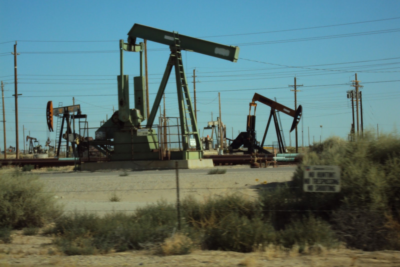
Oilfields outside of Bakersfield
We were briefly on Route 99 and Interstate 5 and connecting roads between the two. The California landscape was still underwhelming, with oil fields and solar farms providing interest in a not-the-Midwest sort of way. Eventually the arid desert-feel started changing to a greener, agricultural feel. Roses and oleander of assorted colors started to appear in the medians of the highways. Fruit and nut orchards, often lined with palm trees, became more frequent. Hand-written signs advertising avocados ten for a dollar, baskets of strawberries and other fruits lined the roadway as we drove through the most productive fruit and vegetable area of the country. We zig-zagged over to Route 101 which follows in part the historic El Camino Real (“The Royal Road”), a route early missionaries used to visit their mission outposts between San Diego and San Francisco since the 1700s. This highway, just east of the Pacific coastal range, was more scenic and as fast as the previous two roads we were on. We continued on Route 101 north of Monterey where we headed west to the iconic Route 1 coastal highway. This proved to be a very scenic, somewhat twisty, and occasionally touristy-slow ride that was worth every minute of it. The road had non-stop views of the Pacific Ocean and was studded by state beaches all along its shoreline.

Along the "Royal Road"
 

Sea Cliff State Beach
We decided lunch would be a “surprise adventure” at one of the parks. We randomly picked Sea Cliff State Beach, south of Santa Cruz, grabbed our backpack of hiking lunch food and drinks, and headed to the beach. It was mid-day and crowded, the lower beach parking lot full, so we parked on the cliff and walked the hundreds of steps down to the beach. The beach had an RV camping area, a large pier and what looked like a tanker, crashed and sunk at the end of the pier. The tanker was covered with sea birds of all kinds, using the ship as a taking off place to go diving for lunch in the ocean. Some research on Wikipedia would later reveal that the tanker, the SS Palo Alto, was deliberately brought and sunk there in 1929, the pier built to access the ship as an entertainment venue with a swimming pool, a cafe, and a dance floor. People danced for two years on the ocean before the company running the facility went bankrupt, and the tanker was given over to the birds and fish as an artificial reef. The pier to the ship was still in part accessible, so we ate our lunch there, watching the pelicans dive in the water, watching people fishing from the pier and watching others swimming in the ocean. We walked down the beach and one of us stood bare-foot in the water so that person could say they had stood in both the Atlantic and the Pacific Oceans. (The other person did not want to get their feet sandy...) We climbed up the stairs back to the car and continued north on the coastal highway.

SS Palo Alto, sunk at the end of the pier...
...now covered with birds


Which one of these people is standing barefoot in the Pacific?


Wind surfers along the coastal highway
We stopped several times along the way at overlooks, drinking in the rocky coastline along the ocean, watching windsurfers, until it was time to head inland to our hotel to get ready for the dinner. The distance between the coast and the main highway that would take us to Cupertino was short, about 30 miles. I choose a straightforward route between the two that turned out to be anything but straight. On the map it appeared as two straight roads meeting at a right angle in the tiny village of La Honda. In reality, it was an extreme roller coaster ride through a dense, dark redwood forest with non-stop up and down and 10 mph S-curves the entire way. My husband, who had cut his driving teeth on the notoriously twisty Route 6 along the side of a Hudson highland cliff overlooking the Hudson River near where he grew up, pronounced this present route he was driving as the worst road – EVER! Even the fact that we had passed – unintentionally - within a mile or so of Neil Young's Broken Arrow Ranch did nothing to make the ride more attractive to him.

We finally arrived at the hotel, changed for the rehearsal dinner, and set out for a large California ranch home nestled in a neighborhood between suburban San Jose and the wooded hills we had been winding our way through earlier. It was good to see familiar faces, family of the wedding couple we already knew and family we met for the first time that night. The dinner was outdoors, the night was perfect in weather, temperature and lack of bugs, a combination I would learn, though rare in the midwest, is not uncommon in the central California area. A good ending to a long day...


Difficult roads often lead to beautiful destinations - Unknown


Next:

A Redwood Wedding

The Trip – Day 11
The Wedding, Sanborn County Park, Saratoga, California
20 miles

and

The Trip – Day 12
Cupertino, California – Mariposa, California
159 miles

Sunday, July 31, 2016


Sun and Gun

The Trip – Day 9
Valle, Arizona – Bakersfield, California
483 miles


The day after our visit to the Grand Canyon, we got up early, checked out of our quaint but breakfastless hotel and drove awhile before stopping for breakfast in Williams, Arizona. This small town contained some of the remnants of the old Route 66, the popular highway used in the days before the interstates to travel from Chicago to Los Angeles. Route 66 no longer exists as a continuous road, but pieces of it, with historical restaurants and buildings, remain in towns found along the interstates that replaced it. Today was to be a long driving day, backtracking in part almost 150 miles over the same roads we had traveled two days before. The land surrounding Interstate 40 through northern Arizona into California was not as spectacular as the land we had been seeing in Colorado and Utah, but still interesting in a not-the-midwest sort of way. The hills looked a little like a more deserty version of western Colorado, with large wind farms in some areas. The weather was hot – 103 degrees for much of the day – and the sun was, well, relentless...

Before our trip, people had told us about the heat and sun in the southwestern part of the country. It gets hot, they said, but it's a dry heat, very little humidity. And it's always sunny, lots of bright sunshine, they said, like it was a good thing. For someone like me who struggles with Reverse Seasonal Affective Disorder,* the constant sun was starting to get to me. The rain of eastern Illinois on the first day of our trip was a distant memory. Except for a very brief shower we drove through the morning of our Las Vegas adventure, there had been constant, relentless sun. My son, returning to the midwest after living in El Paso for two years, said one of his reasons for leaving Texas was the relentless sun. (He suffers from Reverse S.A.D as well...) During the travels of this day I finally grasped what he meant by “relentless”. The sun in the southwest just doesn't let up. It is blinding to look east in the morning, similarly blinding to look west in the evening, and it beats down unimpeded by clouds the rest of the day. The unfiltered intensity of the light out here was of a radically different quality than the east coast and midwest sun I already had a grudging relationship with. The 103 degree heat didn't help. Humidity or no, hot is hot. Fortunately, we were two days ahead of a heat wave. The roads we traveled today would experience 120 degree temperatures later that week. Relentless...
 
We entered California at Needles, south of the Mojave Desert. My first experience of the state was more heat and light with the addition of haze from wildfires burning out of control north of Los Angeles. We left the interstate at Barstow and stopped for lunch, again along the remnants of Route 66. With no reservations for a hotel that night, we pushed our mileage a bit further, deciding to stop at Bakersfield for the night.

When we don't have reservations for a place to spend the night, we usually look for an inexpensive chain hotel. The night before such a stop, I would look on Google Maps to see what areas of what towns have clusters of cheap hotels and see what prices and overall ratings are for hotels in those areas. We got off the exit in Bakersfield where my research the night before indicated a collection of places to sleep. We were about to pull into a Red Roof Inn when I saw a Motel 6 a little farther down the road. I suggested we go there instead. I had remembered the Motel 6 at this exit was very highly rated. We pulled into the parking lot and looked around. Like many hotels we found in the mild climate of the west, this one had outside entrances to the rooms, but looked clean and well-maintained. The room was beautiful – newly renovated, sparkling clean, with a refrigerator with a freezer for our cooler ice packs, a microwave, great pillows, a great showerhead, and a comfy mattress. There was a laundromat down the road, and we were able to wash nine days of dirty clothes efficiently. We finished our laundry, grabbed something to eat, then returned to our clean, cool hotel room. After a long, hot day of driving, and still recovering from the Grand Canyon hiking of the day before, we went to bed early and fell asleep quickly.

The next morning I woke up feeling well-rested. My husband, however, did not have the same experience. “Are you O.K.? Weren't you scared?” he asked me. “Didn't you hear the yelling outside our room and the doors slamming and the sirens at 2 a.m.?” I told him I had the best night's sleep of the trip. He told me he lay in bed afraid to move because of the loud arguing going on outside our door. Never heard a thing, I told him. We got up, packed the car, and he went to check out. He returned and told me things last night were worst than he had imagined. The clerk at the desk, very apologetic for all the noise that night, told him two men had been shot in the parking lot right outside our room. My husband was right to have been scared. I was right to have slept through it. We kept track of the news feeds on the shooting for several days. Both men survived, but the shooters were still on the loose. Ironically, I had just warned my adult children to think twice about going into Chicago this summer because of the violence. That same weekend Chicago would see 59 shootings with 13 fatalities. And here we were, in sunny California, far from the south side of Chicago, with a gunfight at our door...


*Seriously! See The Angle, “God of the Gray Day”, February 10, 2016


Traveling - It leaves you speechless, then turns you into a storyteller. - Ibn Battuta


Next:

Dancing in the Pacific

The Trip – Day 10
Bakersfield, California – Cupertino, California
Sea Cliff State Park, The Coastal Highway, The Road to La Honda
335 miles

Friday, July 29, 2016


Grand!

The Trip – Day 8
The Grand Canyon
48 miles


Throughout this road trip there had been a gradual building up of grandeur – first the distant sight of the Rocky Mountains, then Glenwood Canyon, Colorado National Monument, the ever-changing landscape of the Colorado and Utah roadways, culminating in the overarching...awe...some... heights of the red rocks of Zion. I didn't know what to expect from a canyon called “grand”. 

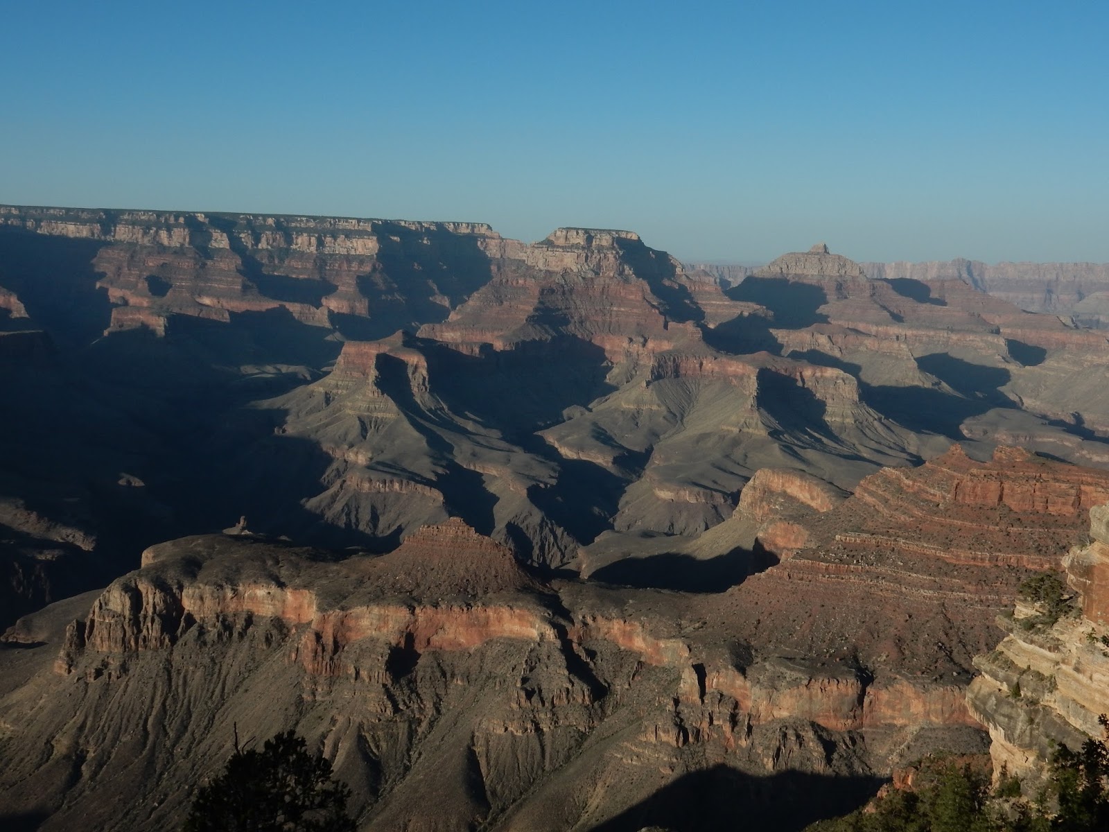
It did not disappoint. The Grand Canyon truly is grand. While the Kolob Canyons and the rest of Zion National Park overwhelms one's senses with its towering heights, the Grand Canyon overwhelms with its depths and distance and ever-changing canyons and colors. It took my brain a good part of the morning to wrap itself around the immenseness of what my eyes were seeing.

We arrived at the south rim early, got a parking spot, and started walking. Accepting that we were POACA*, we decided to stay on the relatively flat rim trails all day and not venture, even part way, down into the mile-deep canyon. The morning was jacket-cool, but the day would be in the 80s on the rim, in the 100s down in the canyon. The entire canyon was carved out by 277 miles of the Colorado River, but the “official” National Park sections consist of the somewhat remote north rim and the more popular, more touristy south rim, where we opted to visit. The south rim area of the park stretches over 30 miles along the canyon, with a mostly paved level trail running along 13 miles of that distance. A road also runs parallel to the rim, though parts of it are accessible by shuttle bus only. We headed west to that section of the park closed to cars but rich with overlooks. We had been so happy with the shuttle bus system at Zion that we left our car in the parking lot in the Grand Canyon all day and took the bus to various overlooks (There are many!) and walked between several of them along the rim trail. The park got crowded later in the day, but the Grand Canyon shuttle system was efficient, though the buses did not come quite as frequently as those in Zion. They also didn't make us feel quite as old, probably because there was more competition for the coveted front seats from other POACA**. 


The Bright Angel Trail
Though we did not venture into the canyon, we did go to a viewing area overlooking Bright Angel Trail, a popular hike down to the Colorado River. There are camping areas available in the canyon as the 15 mile or so round trip will take approximately 12 hours, and the National Park Service warns against trying to make the trip in one day. There is a small bridge over the Colorado River for those who have the days and energy to hike from the south rim to the north rim. + For us, it was enough to wander from overlook to overlook along the rim trail, just soaking in the magnificent ever-changing expanses of canyon and glimpses of river. In certain sections, we could see rafters on the Colorado River. One of the bus drivers told us that on a quiet day you could hear their screams as they go through the rapids. On the day we were there, the rafters could be seen, but not heard. My husband's paparazzi lens came through again, and we were able to capture several rafts going down the river in the canyon.


The bridge over the Colorado River down in the Canyon
Rafters on the Colorado River


View of Grand Canyon Village
The Grand Canyon has been a tourist attraction since the early 1900s and is one of the most developed national parks, with lodges, campgrounds, restaurants, markets, a train station, several museums and visitor centers. After a long day of walking and looking, we were hungry, tired, and knew the dinner choices were none back near our hotel in tiny Valle. We tried one of the restaurants in the park, in the Yavapai Lodge, and found it had great food, an informal setting and unlimited drink refills. Revived, we hopped on the shuttle again one last time before leaving, this time heading east to view the changing light in the ever-changing canyon as the sun dropped low in the sky. It was...grand... 


Evening sun in the Canyon
 
End of the day


* People Of A Certain Age

** I don't really have to explain this anymore, do I?

+ We personally know two people, ultra-marathon runners, who ran down from the south rim, up to the north rim, and back (!!!!!) in one day. They considered it a training run. Don't tell the park service...


...the Grand Canyon is a sort of landscape Day of Judgment. It is not a show place, a beauty spot, but a revelation. The Colorado River, which is powerful, turbulent and so thick with silt that it is like a saw, made it with the help of the erosive forces of rain, frost, and wind, and some strange geological accidents; and all these together have been hard at work on it for the last 7 or 8 million years. It is the largest of the 18 canyons of the Colorado River, is over 200 miles long, has an average width of 12 miles and is a good mile deep. It is the world's supreme example of erosion. But this is not what it really is. It is, I repeat, a revelation. The Colorado River made it, but you feel when you are there that God gave the Colorado River its instructions... - J.B. Priestley, from Midnight on the Desert


Nearly everybody, on taking a first look at the Grand Canyon, comes right out and admits its wonders are absolutely indescribable, and then proceeds to write anywhere from 2,000 to 50,000 words giving the full details. . . . When the Creator made it, He failed to make a word to cover it. - Irvin S. Cobb


Next:

Sun and Gun

The Trip – Day 9
Valle, Arizona – Bakersfield, California
483 miles